

 Detailed Description of the current Version
 Data Sheets of all Database Tables Database Examples Prices of the Geodata Germany
 Download
Place order
Download
Place order
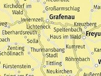
Geodata Germany consists of a number of database tables with administrative, postal, telephone area, landscape, nature area, climatical and cartographical contents as area-related center coordinates. All database tables can be linked to each other using the data keys they contain. Each data table is accurately described in a detailed data sheet. Here you have the opportunity to view the data sheets stored as PDF files or to download them from the Internet.
 Specification of the Town and Municipality database ORTREF with georeferences Specification of the Town and Municipality database ORTGEM without georeferences Specification of the Town Quarter database ORTTLREF with georeferences Specification of the Town Quarter database ORTTLGEM without georeferences Specification of the Postal Code database PLZREF with georeferences Specification of the Postal Code database PLZGEM without georeferences Specification of the Telephone dialling code database VORWREF with georeferences Specification of the Telephone dialling code database VORWGEM without georeferences Specification of the Administrative County database KREIS Specification of the Administrative District database REGBEZ Specification of the Federal States of Germany database LAND Specification of the Landscape database LANDSCH Specification of the database with Nature Area Units NATRAUM Specification of the database with Snow and Wind Load Zones LASTEN Specification of the database with Solar data SOLAR Specification of the database with Travel Areas and Urban Specificities REISEGEB Specification of the database with infos of the cartography TK25 Specification of the database with infos of the cartography TK50 Specification of the database with infos of the cartography TK100 Specification of the database with infos of the cartography TKUE200
 In order that you are always well informed about our company, we write actual news, current information and special offers here into this column.
 Read more...
Read the work sheet...
Read the work sheet...
Read the work sheet...
Read the Press Release... To the NTv2 collection...
new languages can be added at any time by creating new language files.
Everybody who is interested can translate a new language file into his native language for himself and all users.
Read more...
Read the work sheet...
Read the work sheet...
Read the work sheet...
Read the Press Release... To the NTv2 collection...
new languages can be added at any time by creating new language files.
Everybody who is interested can translate a new language file into his native language for himself and all users.